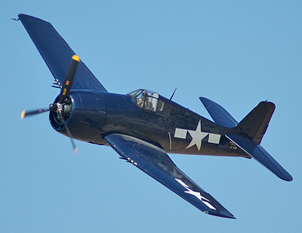
First Try ___ Terry Weathers, Bill Lloyd, Jim Gubetta, Bruce Batchelder. June 8.
We ran up the South Fork of the Sacramento River on Road 26 to and through Mumbo Basin, intersecting Road 25 (these are county numbers, I think) at a gulch whose name I have already lost (there are a LOT of gulches up here). We then followed 25 generally west along the East Fork of Trinity River, looking for a north-bound spur that might lead into the target, Section 11.
After many stops to check our route (see map) we hit a road that led to the Altoona Mine which is just a section west from the Integral Mine which is just a section away from ours, number 11. The Altoona mined cinnabar, the ore that produces mercury and it has been leaching into Trinity Lake so the EPA's Superfund just finished burying all the mine tailings in a clay-lined pit and sealing it. I'll attach a picture.

Anyway, several backups, some don't-go-there skid paths later we hit 38N24 which led up the west side of section 11 and back to 26 at the top, and home. Enroute we found one of Jim Nile's old markers dated 6/5/57, I'll attach a photo. It says we were standing 1,610 chains east of the junction of sections 10,11, 15, & 14 (left to right, top to bottom).
So in short we did not find the plane but we did encircle the section where its remains were last seen and
we are reasonably certain that we can penetrate the area from the west, coming down 38N24 from county road 26. There looked to be at least two spur roads leading into the search area.

We think that the craft may have impacted in the north part of the section, along an east-west cruise line that Jim Nile performed in 1954 and that the Navy may have dragged the larger parts of the wreck to an open mine pit lower down the slope where Jim Gubetta saw it in 1957. This was close to the old county road where they probably trucked it out for salvage. Depending on how extensively the ground was disturbed with logging both sites should give up some evidence of the wreck.
Another trip is planned, more direct this time, to pinpoint both the pit and the higher impact point. If we can establish either we will advise the wider group that (or not) a formal survey may be in order. The tentative date for this second visit is Friday 19 June and we will again meet at the dam at Lake Siskyou, this time at 8am in order to give us enough time on site.
Please let me know if you are interested in this one. As you can see from the photos a 4WD vehicle with high clearance is helpful. The first tour was about 100 miles but this should be maybe half that as we have a much better idea of where to go. We also learned that cell phone signal strength is little to none so I'm hoping we can round up some walkie talkies, especially if we also have ATV's to work with. The terrain is steep but there are innumerable skid roads and ATV's could fan out and report back.
In the meantime Jim suggested finding out who logged that section since 1957 and Jason volunteered to check USFS records. Jim will also work with Jim Nile who is the other eyewitness (saw blue metal about 3/8 mile from the north edge of the section) because Nile may be able to help us locate who logged the area since the 1950's. We think it may have been done in the 70's or 80's and if we can locate any fallers who worked that slope we might obtain more exact location details.


No comments:
Post a Comment